It had been four days since I dropped off Kevin and his daughter Katie at the Pacific Crest Trailhead at Snoqualmie Pass. For two months, this intrepid pair had been working their way northbound on the trail — through northern California, then Oregon, then Washington. They had dealt with boots ruined by lava rock trails, and trekking poles that just wore out from the constant hiking. They had overcome separate bouts of illness from bad water in California and had already detoured twice around major forest fires in Oregon. With strength, grit, and determination they were making steady progress to their goal at the Canadian border, hiking up to 20 miles each day.
Then at 5PM on Monday, my phone beeped with a text message.
“We are in some trouble from smoke inhalation. Only did 12 miles, still have 15 tomorrow. I have vomited. Camping here tonight. Not feeling good. Very weak . . . not sure how far I can walk.”
The 8,000-acre Bolt Creek Fire had blown up the day after Kevin and Katie started north from Snoqualmie Pass, resulting in the evacuation of the town of Index, Washington and closure of Highway 2, one of the three key routes over the Cascades. Winds blew from the east, blowing acrid smoke across Puget Sound with resultant air quality readings plunging to unhealthy levels. At our house, we kept windows shut for two days, waiting for winds to shift and clear the air. When the winds did shift, we all breathed with relief, not realizing it might put our friends in peril.
I had been monitoring the fire closely, because Highway 2 was my direct route to Steven Pass — my next planned re-supply rendezvous with Kevin and Katie. If this route stayed closed, my only option to reach them would be to detour east over Snoqualmie Pass, then north over Blewett Pass, then to ascend Stevens Pass from the east. Under good conditions, this would be a 3-hour drive each way.
After reading the text message from Kevin, I quickly went to my mapping program to plot the coordinates provided via their Garmin satellite beacon, which was now functioning as a critical emergency communication device. I was able to see their location just south of Surprise Lake. I was able to see that a 4-mile trail would lead them more directly to Highway 2. I could also see that this route was mostly downhill, and was hoping that Kevin could manage a slow hike out in his weakened state.
I next called the King County SAR Coordinator (who was at the time assisting with Bolt Creek Fire evacuations). When I informed him of my friends’ situation and asked his advice, his response “Well, with all this smoke, we won’t be able to do a helo extraction tonight,” did not surprise me.
I then texted a confirmation of the exit route to Kevin, along with the advice to hunker down for the night, and attempt to hike out the next morning. We agreed that Kevin would send a location update via his Garmin Mini once every hour, so that I could monitor their progress as they hiked out.
On Tuesday morning, I left my house at 5:30AM to head out over the pass, only to discover a slow leak in my right rear tire. After a two-hour delay in Issaquah to get the tire fixed, I was finally headed up toward Snoqualmie Pass and another two hours of driving.
Winds were now from west to east, and smoke from the Bolt Creek Fire was spreading over hundreds of square miles. I could see increasing levels of smoke as I crossed Snoqualmie Pass and drove down into eastern Washington. Just after 8:30AM, I received a text from Kevin, and was relieved to see that (1) they had started their hike out, and (2) they had found the correct junction to their exit route, the Surprise Lake Trail.
After I turned north on Hwy 97, the smoke increased as I drove over Blewett Pass and headed toward the town of Leavenworth. By 10:30AM, I was passing through Leavenworth, and started to see signs “Highway 2 Closed at Stevens Pass.” My planned rendezvous with Kevin and Katie was the Surprise Creek Trailhead, about a mile west of the pass. Would I be able to cross the pass to reach them from the east? Would I have to talk the State Patrol into allowing me to drive through? I just didn’t know.
At 11:00AM, I was nearing Stevens Pass and the smoke was gradually getting thicker. The normally busy highway was eerily empty except for a few construction vehicles. My phone pinged with another text from Kevin, and I pulled over.
“Just reached trailhead. Really tired. Haven’t eaten anything since noon yesterday.”
I responded “I should be there within 30 minutes,” (at the time, thinking I was very close and would actually be there within 10 minutes).
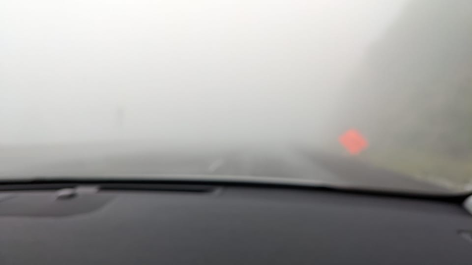
Back on the road, I was soon less than a quarter mile from the Stevens Summit, when smoke channeling through the pass was suddenly so thick that I couldn’t see 20 feet in front of me. I slowed to about 10 mph and turned on my hazard flashers, hoping that there were no vehicles behind me. For the next 15 minutes, I crawled over and down the west side of the pass, staying on the road by watching for orange construction cones along the right shoulder.
Finally, I had descended enough so I could see the road ahead of me, and zoomed back up to 20mph. I located the (unmarked) turnout leading to the Surprise Creek Trailhead, and then located the (unmarked) gravel side road that led to where Kevin and Katie were waiting for salvation. The smoke here was thick, but not overwhelming. As we hastily packed their gear into my car, I gave Kevin a bottle of electrolyte-replacement sports drink, which he thankfully sipped as we drove away from the trailhead.
As we ascended back up and over Stevens Pass, Kevin and Katie were stunned to see how thick the smoke was, but relieved to be on their way home. Kevin’s view of the experience can be found on his blog “The Gray Mountaineer”:


Thanks for your dedication and service Suzanne.