Edwin Birch and his son are lost and SAR is called into action
In July 2014 Suzanne, Keb and I were deployed on Mt Rainier to search for 64-year-old Edwin Birch and his son who had set out on a “key exchange” hike of the 18-mile segment of the Wonderland Trail between Box Canyon and Fryingpan Creek. When Edwin failed to appear as had been agreed at the Fryingpan Creek Trailhead, Rainier NPS rangers initiated a multi-day search.
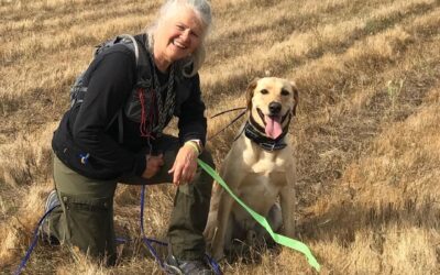
Guy and Suzanne wait for their assignment
The Mount Rainier National Park Service (NPS) incident manager contacts the Washington State Emergency Management Division, with a request for mountain rescue resources. A large and urgent search mission is spinning up. On the two-hour drive south to the White River Ranger Station, Suzanne and I chat about our experiences on Mount Rainier while K9 Keb snoozes in the back seat.

As we arrive at incident command and wait for our search assignment, we hear two younger searchers wondering how a person could possibly get lost on a well-traveled hiking trail. I know exactly how. Ten years ago, I got lost on a solo backpacking trip in the same snow-covered regions of Panhandle Gap that Edwin Burch attempted to traverse. My route was identical to that planned by Edwin and his son: from Fryingpan Creek Trailhead to Summerland high camp, over Panhandle Gap, down through Indian Bar, and on to Box Canyon. What I distinctly remember is my growing uneasiness as snow continued to fall and my sense of being lost continued to rise.
Guy’s Story: The decision points of an experienced hiker lost on a well-traveled trail
After a night of continuous heavy rain at the Summerland high camp, I had hoisted my waterlogged pack and began to climb slowly to the southeast. As I picked my way carefully through rock and talus, low clouds obscured all but the nearest of features. Gradually I gained altitude, and just as gradually the light rain turned to snow, which at first melted when softly meeting the dark rocks, but soon began to linger here and there.
The trail becomes shrouded in snow
As I read 6,400 feet on my watch altimeter, the trail leveled out slightly, but the rocky path was being masked by larger and larger patches of fresh snow. Snowfall was light but steady, and as more of the trail became shrouded in white I back-checked, and made a mental note of the terrain behind me so that I could retrace my steps if necessary.
Crossing a frozen creek
I soon encountered one of the high tributaries of Fryingpan Creek, spanned via a narrow, snow-covered wooden bridge. I could see a tongue of snow crossing the small stream, but it was hard to tell where the bridge edges were, and a fall into the icy water would have proved fatal. Probing here and there with the tip of my ice axe, I crossed step-by-step. Once across, I topped a rounded rise, and as I ascended across its shoulder, a hidden lake appeared to my right, pale blue-green, bordered by rock, and cradled in snowfields.
After contouring around the lake, I followed the trail up through rocks to where it disappeared under a short steep snowfield. I could see shallow depressions of boot tracks left by two hikers who departed a mere 30 minutes before me. The tracks led up between large rocks and into a snowy notch in the rock band above me. I placed my feet in the tracks ahead of me, used my ice axe for balance, and slowly climbed up the snowfield.
An impassable barrier of cliffs
Once above the ridge (was that Panhandle Gap already?), I had surveyed the terrain. Ahead loomed an impassable barrier of cliffs, forcing me to turn eastward. Once again, the trail disappeared, this time under a vast snowfield that swept across to my left, and faded far into the snowy distance. In the snow at my feet, I could see faint boot prints that climbed almost directly up the snowfield to meet a hard-to-see track that traversed to the left across a steep slope.
I shifted my ice axe into my uphill hand, adjusted my heavy pack, and then proceeded up the slope. The snow was firm, and angled about 45 degrees: this was really difficult going. Ahead of me, the future was obscured by fog and falling snow; below me, a much clearer possibility seemed to be a misplaced step, followed by a short but steep slide into rocks at the base of the snowfield. An injury or broken ankle up here would have been a life-threatening occurrence.
Back on the trail: confident but concerned
Mentally I added the risk factors and winced at the sum. With each step I firmly planted my ice axe, and kicked my boot into the next depression to make an edge in the snow about one quarter the width of my boot. I adjusted my grip on the ice axe to ready myself for a quick self-arrest (or at least a quick attempt at a self-arrest) should I slip. After several minutes of step-by-step progress, I had traversed the steepest part of the snowfield, and much to my relief, the angle let up. Shortly afterwards, the snowfield flattened out, and then ended as I had stepped onto bare rocks again. I felt a wave of relief to be back on a recognizable trail. I was still confident of my route, but had started to hear a quiet voice of concern in the back of my head. Had Edwin heard that same voice?
The Search for Edwin begins
Finding the decision points

For Suzanne, Keb, and I, our search begins when our helo floats down to land on a small heather patch amidst high snowfields. As we begin our search, I scan for “decision points:” places where a tired or distracted hiker might miss a turn or take a wrong one. Park rangers know that the Panhandle Gap trail section has many such decision points, and almost every year hikers get in trouble up here. Not far from our insertion point, we pause to study the map, and can see that the route of the Wonderland Trail (obscured by snow this early in the season) jogs up and left, while a natural broad “alley” leads invitingly downhill to the right. This would be the perfect terrain to misdirect Edwin and lead him toward the steep cliffs below. I know how deceiving this terrain can be from my own past misadventure on the same route.
The Lost Leading the Lost
Guy’s final decision point
As snow continued to fall over Panhandle Gap on my hike years ago, the gap of time between my predecessors and me had become a real factor. Ahead of me on the trail, the tracks of the hikers were still there, perhaps only thirty minutes old as I came upon them, but already mostly hidden by fresh snow. I needed to keep making progress with minimal rest stops. I remember one of the pair of boot tracks had a wagon-wheel design on the heel, a distinctive mark to follow. As the trail became less and less clear, I was reduced to following the wagon wheel tracks across scattered small snowfields. Gradually, I realized something. I could see the tracks heading out before me, and there along the side, the same boot prints were returning. The lead hikers were lost, and I’d been following their tracks! As snow continued to fall over Panhandle Gap, the lost were following the lost.
Well, I could still follow the boot prints before me. I decided to see where they led and started tracking in earnest. Where they stepped, I stepped. It was still snowing, so I had a real concern now that I might lose their tracks altogether. The boot prints climbed steeply over talus, and then traversed back right, up the side of and onto the top shoulder of a steep snowfield. There was a layer of snow over the brush-covered hillside, and for about 50 yards, my tracking was step-by-step. I was able to locate boot prints ahead of me only one at a time. The boot prints led up over a small hillock, and I was flooded with relief as I looked down to the slope below and saw a partially covered, but unmistakable, trail leading down out of the snowfields and rocks, and into green meadows below.
Being lost: wilderness skills vs. a game of chance
Had I found the trail due to my wilderness skills, or had I simply won that game of chance ten years ago? Had Edwin encountered the same decision points that I had? What choices had he made?


0 Comments